
Clouds form as a result. How are clouds formed? Types of clouds with descriptions and photos
Everyone has seen clouds. They are large and small, almost transparent and very thick, white or dark, pre-stormy. Taking various forms, they resemble animals and objects. But why do they look like that? We will talk about this below.
What is a cloud
Anyone who has flown in an airplane has probably "passed" through the cloud and noticed that it looks like fog, only it is not directly above the ground, but high in the sky. The comparison is quite logical, because both of them are ordinary steam. And it, in turn, consists of microscopic droplets of water. Where do they come from?
This water rises into the air as a result of evaporation from the surface of the earth and water bodies. Therefore, the greatest accumulation of clouds is observed over the seas. During the year, about 400 thousand cubic kilometers evaporate from their surface, which is 4 times higher than that of land.
What are there? It all depends on the state of the water that forms them. It can be gaseous, liquid or solid. It may seem surprising, but some clouds are actually made of ice.
We have already found out that clouds are formed as a result of the accumulation of a large number of water particles. But to complete the process, a link is needed, to which the drops will "stick" and come together. Often this role is played by dust, smoke or salt.
Classification
The height of the location largely determines what clouds are formed from and how they will look. As a rule, the white masses that we are used to seeing in the sky appear in the troposphere. Its upper limit varies depending on the geographical location. The closer an area is to the equator, the higher standard clouds can form. For example, above an area with a tropical climate, the boundary of the troposphere is located at an altitude of about 18 km, and beyond the Arctic Circle - 10 km.
Cloud formation is also possible at high altitudes, but they are currently little studied. For example, mother-of-pearl appear in the stratosphere, and silver ones appear in the mesosphere.
Clouds of the troposphere are conditionally divided into types depending on the height at which they are located - in the upper, middle or lower tiers of the troposphere. Air movement also has a big impact on cloud formation. In a calm environment, cirrus and stratus clouds form, but if the tropospheres move unevenly, cumulus clouds are more likely to appear.
Upper tier
This gap covers the area of the sky at an altitude of more than 6 km and up to the edge of the troposphere. Considering that the air temperature here does not rise above 0 degrees, it is easy to guess what clouds form in the upper tier. It can only be ice.

In appearance, the clouds located here are divided into 3 types:
- Cirrus. They have a wavy structure and can look like individual threads, stripes or whole ridges.
- cirrocumulus consist of small balls, curls or flakes.
- Cirrostratus are a translucent likeness of a fabric that "covers" the sky. Clouds of this type can stretch over the entire sky or occupy only a small area.
The height of a cloud located in the upper tier can vary greatly depending on various factors. It can be several hundred meters or tens of kilometers.
Middle and lower tier
The middle tier is a part of the troposphere, usually located between 2 and 6 km. Here there are altocumulus clouds, which are three-dimensional gray or white masses. They consist of water in the warm season and, accordingly, of ice in the cold. The second type of clouds are altostratus. They have and often completely cover the sky. Such clouds carry precipitation in the form of drizzle or light snow, but they rarely reach the surface of the earth.

The lower tier represents the sky directly above us. Clouds here can be of 4 types:
- Stratocumulus in the form of blocks or shafts of gray color. Can carry precipitation, except when the temperature is too low.
- layered. They are located below all the others, have a gray color.
- Layered rain. As you can understand by the name, they carry precipitation, and, as a rule, they are of a continuous nature. These are gray clouds that do not have a specific shape.
- Cumulus. One of the most recognizable clouds. They look like powerful heaps and clubs with an almost flat base. Such clouds do not bring precipitation.
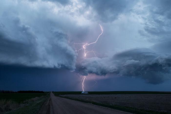
There is another species that is not included in the general list. These are cumulonimbus clouds. They develop vertically and are present in each of the three tiers. Such clouds bring showers, thunderstorms and hail, so they are often called thunderclouds or showers.
Cloud Lifespan
For those who know what clouds form from, the question of their lifespan may also be of interest. Humidity plays a big role here. It is a kind of source of vitality for the clouds. If the air in the troposphere is dry enough, then the cloud cannot survive for long. If the humidity is high, it may hover in the sky longer until it becomes more powerful in order to produce precipitation.
As for the shape of the cloud, its life span is very short. Water particles tend to constantly move, evaporate and reappear. Therefore, the same cloud shape cannot be preserved even for 5 minutes.
Like fogs, clouds are formed by the condensation of water vapor into liquid and solid states. Condensation occurs either as a result of an increase in the absolute humidity of the air, or as a result of a decrease in air temperature. In practice, both factors are involved in cloud formation.
The decrease in air temperature is due, firstly, to the rise (ascending movement) of air masses and, secondly, to advection of air masses - their movement in a horizontal direction, due to which warm air can be above the cold earth's surface.
We confine ourselves to discussing the formation of clouds caused by a decrease in air temperature during an upward movement. It is obvious that such a process differs significantly from the formation of fog - after all, the fog practically does not rise up, it remains directly at the earth's surface.
What makes air rise up? There are four reasons for the upward movement of air masses. The first reason is the convection of air in the atmosphere. On a hot day, the sun's rays strongly warm the earth's surface, it transfers heat to the ground air masses - and their rise begins. Cumulus and cumulonimbus clouds are most often of convective origin.
The process of cloud formation begins with the fact that some air mass rises. As you rise, the air will expand. This expansion can be considered adiabatic, since the air rises relatively quickly, and therefore, with a sufficiently large volume of it (and a really large volume of air is involved in the formation of a cloud), the heat exchange between the rising air and the environment simply does not have time to occur during the rise. During adiabatic expansion, air, without receiving heat from outside, does work only due to its own internal energy, and then cools down. So, the air rising up will be cooled.

When the initial temperature T 0 rising air will drop to dew point T p corresponding to the elasticity of the vapor contained in it, the process of condensation of this vapor will become possible. In the presence of condensation nuclei in the atmosphere (and they are almost always present), this process really begins. Height H, at which vapor condensation begins, determines the lower boundary of the forming cloud. It is called the level of condensation. In meteorology, an approximate formula for height is used H(the so-called Ferrel formula):
H = 120(T 0 −T R),
where H measured in meters.
The air that continues to flow from below crosses the condensation level, and the process of steam condensation occurs already above this level - the cloud begins to develop in height. The vertical development of the cloud will stop when the air, having cooled, stops rising. In this case, a fuzzy upper boundary of the cloud will form. It is called the level of free convection. It is located slightly above the level at which the temperature of the rising air becomes equal to the temperature of the surrounding air.
The second reason for the rise of air masses is due to the terrain. The wind blowing along the earth's surface may meet mountains or other natural elevations on its way. Overcoming them, the air masses are forced to rise up. The clouds formed in this case are called clouds of orographic origin (from the Greek word όρος, meaning "mountain"). It is clear that such clouds do not receive a significant development in height (it is limited by the height of the elevation overcome by the air); in this case, stratus and nimbostratus clouds arise.
The third reason for the rise of air masses is the occurrence of warm and cold atmospheric fronts. Cloud formation occurs especially intensely over a warm front - when a warm air mass, advancing on a cold air mass, is forced to slide up a wedge of receding cold air. The frontal surface (the surface of the cold wedge) is very flat - the tangent of its inclination to the horizontal surface is only 0.005–0.01. Therefore, the upward movement of warm air differs little from the horizontal movement; as a consequence, the cloudiness that arises above the cold wedge develops weakly in height, but has a significant horizontal extent. Such clouds are called upslip clouds. In the lower and middle tiers, these are nimbostratus and altostratus clouds, and in the upper tier - cirrostratus and cirrus (it is clear that the clouds of the upper tier are already formed far behind the atmospheric front line). The horizontal extent of upward slip clouds can be measured in hundreds of kilometers.

Cloud formation also occurs above a cold atmospheric front - when an advancing cold air mass moves under a mass of warm air and thereby raises it. In this case, cumulus clouds may also form in addition to upslip clouds.

The fourth reason for the rise of air masses is cyclones. Air masses, moving along the surface of the earth, twist towards the center of the depression in a cyclone. Accumulating there, they create a pressure drop along the vertical and rush upward. Intensive rise of air up to the border of the troposphere leads to powerful cloud formation - clouds of cyclonic origin appear. It can be stratified-nimbus, altostratus, cumulonimbus clouds. Precipitation falls from all such clouds, creating rainy weather characteristic of a cyclone.
Based on the book by L. V. Tarasov “Winds and Thunderstorms in the Earth’s Atmosphere” (Dolgoprudny: Publishing House “Intellect”, 2011).
Light, fluffy and airy clouds - they pass over our heads every day and make us raise our heads up and admire the bizarre shapes and original figures. Sometimes an amazing kind of rainbow breaks through them, and sometimes - in the morning or in the evening during sunset or sunrise, the clouds illuminate the sun's rays, giving them an incredible, breathtaking shade. Scientists have been studying air clouds and other types of clouds for a long time. They gave answers to questions about what kind of phenomenon it is and what clouds are.
In fact, it is not so easy to give an explanation. Because they consist of ordinary water droplets, which warm air lifted up from the surface of the Earth. The largest amount of water vapor is formed over the oceans (at least 400 thousand km3 of water evaporates here in one year), on land - four times less.
And since it is much colder in the upper layers of the atmosphere than below, the air there cools rather quickly, the steam condenses, forming tiny particles of water and ice, as a result of which white clouds appear. It can be argued that each cloud is a kind of moisture generator through which water passes.
The water in the cloud is in gaseous, liquid and solid states. The water in the cloud and the presence of ice particles in them affect the appearance of clouds, their formation, as well as the nature of precipitation. It is the type of cloud that determines the water in the cloud, for example, shower clouds have the largest amount of water, while nimbostratus clouds have this figure 3 times less. The water in the cloud is also characterized by the amount that is stored in them - the water reserve of the cloud (water or ice contained in the cloud column).


But everything is not so simple, because in order to form a cloud, droplets need condensation grains - the smallest particles of dust, smoke or salt (if we are talking about the sea), to which they must stick and around which they must form. This means that even if the composition of the air is completely supersaturated with water vapor, without dust it will not be able to turn into a cloud.
What form the drops (water) will take depends primarily on the temperature indicators in the upper atmosphere:
- if the air temperature of the atmosphere exceeds -10°C, white clouds will consist of water droplets;
- if the temperature indicators of the atmosphere begin to fluctuate between -10 ° C and -15 ° C, then the composition of the clouds will be mixed (drop + crystalline);
- if the temperature in the atmosphere is below -15°C, white clouds will contain ice crystals.
After appropriate transformations, it turns out that 1 cm3 of the cloud contains about 200 drops, while their radius will be from 1 to 50 microns (the average values are from 1 to 10 microns).
Cloud classification
Everyone must have wondered what clouds are? Clouds usually form in the troposphere, the upper limit of which is at a distance of 10 km in polar latitudes, 12 km in temperate latitudes, and 18 km in tropical latitudes. Often other species can be seen. For example, mother-of-pearl are usually located at an altitude of 20 to 25 km, and silver - from 70 to 80 km.


Basically, we have the opportunity to observe tropospheric clouds, which are divided into the following types of clouds: upper, middle and lower tiers, as well as vertical development. Almost all of them (except the last type) appear when humid warm air rises.
If the air masses of the troposphere are in a calm state, cirrus, stratus clouds form (cirrostratus, altostratus and nimbostratus) and if the air in the troposphere moves in waves, cumulus clouds appear (cirrocumulus, altocumulus and stratocumulus).
Upper clouds
These are cirrus, cirrocumulus and cirrostratus clouds. The cloud sky looks like feathers, waves or a veil. All of them are translucent and more or less freely pass the sun's rays. They can be both extremely thin and quite dense (pinnately layered), which means that it is harder for light to break through them. Cloudy weather signals the approach of a heat front.
Cirrus clouds can also occur above clouds. They are arranged in stripes that cross the vault of heaven. In the atmosphere, they are located above the clouds. As a rule, precipitation does not fall out of them.
In middle latitudes, white clouds of the upper tier are located, usually at an altitude of 6 to 13 km, in tropical latitudes - much higher (18 km). In this case, the thickness of the clouds can range from several hundred meters to hundreds of kilometers, which can be located above the clouds.


The movement of clouds of the upper tier across the sky primarily depends on the wind speed, so it can vary from 10 to 200 km/h. The sky of the cloud consists of small ice crystals, but the weather does not practically give clouds of precipitation (and if it does, then there is no way to measure them at the moment).
Mid-tier clouds (from 2 to 6 km)
These are cumulus clouds and stratus clouds. In temperate and polar latitudes, they are located at a distance of 2 to 7 km above the Earth, in tropical latitudes they can rise a little higher - up to 8 km. All of them have a mixed structure and consist of water droplets mixed with ice crystals. Since the height is small, in the warm season they mainly consist of water droplets, in the cold season - of ice droplets. True, precipitation from them does not reach the surface of our planet - it evaporates on the road.
Cumulus clouds are slightly transparent and are located above the clouds. The color of the clouds is white or gray shades, darkened in places, having the form of layers or parallel rows of rounded masses, shafts or huge flakes. Hazy or wavy stratus clouds are a veil that gradually covers the skies.
They form mainly when a cold front pushes a warm front up. And, although precipitation does not reach the ground, the appearance of middle-tier clouds almost always (except, perhaps, turret-shaped ones) signals a change in the weather for the worse (for example, to a thunderstorm or snowfalls). This happens due to the fact that cold air itself is much heavier than warm air and moving along the surface of our planet, it very quickly displaces heated air masses up - therefore, because of this, with a sharp vertical rise in warm air, first white clouds of the middle tier are formed, and then the rain clouds, whose sky clouds carry thunder and lightning.
Lower clouds (up to 2 km)
Stratus clouds, rain clouds and cumulus clouds contain water droplets that freeze during the cold season and turn into particles of snow and ice. They are located rather low - at a distance of 0.05 to 2 km and are a dense, uniform low overhanging cover, rarely located above clouds (other types). The color of the clouds is grey. Stratus clouds are like large shafts. Cloudy weather is often accompanied by precipitation (light rain, snow, fog).
Clouds of vertical development (conventions)
Cumulus clouds themselves are quite dense. The shape is a bit like domes or towers with rounded outlines. Cumulus clouds can become broken in gusty winds. They are located at a distance of 800 meters from the earth's surface and above, the thickness is from 1 to 5 km. Some of them are able to transform into cumulonimbus clouds and settle above the clouds.


Cumulonimbus clouds can be at a fairly high altitude (up to 14 km). Their lower levels contain water, the upper ones contain ice crystals. Their appearance is always accompanied by showers, thunderstorms, in some cases - hail.
Cumulus and cumulonimbus, unlike other clouds, are formed only with a very rapid vertical rise of moist air:
- Humid warm air rises extremely intensively.
- At the top, water droplets freeze, the upper part of the cloud becomes heavier, lowers and stretches towards the wind.
- A quarter of an hour later, a thunderstorm begins.
upper atmosphere clouds
Sometimes in the sky you can observe clouds that are in the upper atmosphere. For example, at an altitude of 20 to 30 km, mother-of-pearl sky clouds form, which consist mainly of ice crystals. And before sunset or sunrise, you can often see silvery clouds that are in the upper atmosphere, at a distance of about 80 km (it is interesting that these celestial clouds were discovered only in the 19th century).
Clouds in this category may be located above the clouds. For example, a cap cloud is a small, horizontal and altostratus cloud that is often located above clouds, namely above cumulonimbus and cumulus. This type of cloud can form above an ash cloud or a fire cloud during volcanic eruptions.
How long do clouds live
The life of clouds directly depends on the humidity of the air in the atmosphere. If it is small, they evaporate rather quickly (for example, there are white clouds that live no more than 10-15 minutes). If there are many, they can hold out for quite a long time, wait for the formation of certain conditions, and fall to the Earth in the form of precipitation.


No matter how long a cloud lives, it is never in an unchanged state. The particles that make it up are constantly evaporating and reappearing. Even if outwardly the cloud does not change its height, in fact it is in constant motion, since the droplets in it descend, pass into the air under the cloud and evaporate.
Cloud at home
White clouds are pretty easy to make at home. For example, one Dutch artist learned how to create it in an apartment. To do this, he released a little steam from the smoke machine at a certain temperature, humidity level and lighting. The cloud, which turns out to be able to hold out for several minutes, which will be quite enough to photograph an amazing phenomenon.
From the surface of the Earth, it seems that all the clouds are at about the same height. However, there can be huge distances between them, equal to several kilometers. But what are the highest and lowest of them? This post has all the information you need to become a cloud expert!
10. Layered clouds (average height - 300-450 m)
Wikipedia info: Stratus clouds are low-level clouds characterized by horizontal layering with a uniform layer, as opposed to cumuliform clouds, which are formed by ascending warm currents.
More specifically, the term "stratus" is used to describe low-level flat, hazy clouds that range in color from dark gray to almost white.
9. Cumulus clouds (average height - 450-2000 m)
Wikipedia info: "Cumulus" in Latin means "heap, heap". Cumulus clouds are often described as "fat", "cotton-like" or "fluffy" in their appearance and have a flat bottom.
As low clouds, they are usually less than 1000 meters high unless they are a more vertical form of cumulus. Cumulus clouds can appear on their own, in lines, or in clusters.
8. Stratocumulus clouds (average height - 450-2000 m)
Wikipedia Info: Stratocumulus belongs to a type of cloud characterized by large dark, rounded masses, usually in clusters, lines or waves, the individual elements of which are larger than altocumulus clouds, forming at a lower altitude, usually below 2400 meters .
Weak convective air currents create shallow cloud layers due to the drier, still air above them, preventing further vertical development.
7. Cumulonimbus clouds (average height - 450-2000 m)
Wikipedia Info: Cumulonimbus clouds are dense, towering vertical clouds associated with thunderstorms and atmospheric instability, formed from water vapor carried by powerful updrafts.
Cumulonimbus clouds can form alone, in clusters, or as a swell with a squall along a cold front. These clouds are capable of producing lightning and other dangerous severe weather such as tornadoes.
6. Nimbostratus clouds (average height - 900-3000 m)
Wikipedia info: Nimbostratus clouds usually generate precipitation over a vast area. They have a diffuse base, usually located somewhere near the surface at the lower levels and at an altitude of about 3000 meters at the middle levels.
Although nimbostratus clouds are usually dark in color at the base, they are often illuminated from within when viewed from the Earth's surface.
5. Altostratus clouds (average height - 2000-7000 m)
Wikipedia Info: Altostratus clouds are a type of mid-layer clouds belonging to the layer-like physical category, which is characterized by a generally uniform layer that varies in color from gray to bluish-green.
They are lighter than nimbostratus and darker than high cirrostratus. The Sun can be seen through thin altostratus clouds, but thicker clouds can have a denser, opaque structure.
4. Altocumulus clouds (average height - 2000-7000 m)
Wikipedia info: Altocumulus is a type of mid-tier cloud that belongs predominantly to the stratocumulus physical category, characterized by spherical masses or ridges in layers or sheets, the individual elements of which are larger and darker than cirrocumulus clouds, and smaller. than stratocumulus clouds.
However, if the layers become flocculent due to increased air mass instability, then altocumulus clouds become more cumulus in structure.
3. Cirrus clouds (average height - 5000-13.500 m)
Wikipedia info: Cirrus clouds are a type of atmospheric cloud, usually characterized by thin, filamentous filaments.
The filaments of the cloud sometimes form into tufts of a characteristic shape known collectively as mare's tails. Cirrus clouds are usually white or light gray in color.
2. Cirrostratus clouds (average level - 5000-13.500 m)
Wikipedia info: Cirrostratus clouds are a type of thin, whitish stratus clouds made up of ice crystals. They are difficult to detect and are capable of halo formation when they take the form of a thin cirrostratus mist cloud.
1. Cirrocumulus clouds (average height - 5000-13.500 m)
Wikipedia info: Cirrocumulus is one of the three main varieties of upper tropospheric clouds (the other two are cirrus and cirrostratus). Like lower cumulus clouds, cirrocumulus clouds signify convection.
Unlike other tall cirrus and cirrostratus, cirrocumulus are composed of a small amount of transparent water droplets, although they are in a supercooled state.
This article lists and describes all types of clouds.
Cloud types
Upper clouds are formed in temperate latitudes above 5 km, in polar latitudes above 3 km, in tropical latitudes above 6 km. The temperature at this altitude is quite low, so they consist mainly of ice crystals. Upper clouds are usually thin and white. The most common form of upper clouds are cirrus (cirrus) and cirrostratus (cirrostratus), which can usually be observed in good weather.
Middle clouds usually located at an altitude of 2-7 km in temperate latitudes, 2-4 km in polar and 2-8 km in tropical latitudes. They consist mainly of small particles of water, but at low temperatures they can also contain ice crystals. The most common types of mid-tier clouds are altocumulus (altocumulus), altostratus (altostratus). They may have shaded portions, which distinguishes them from cirrocumulus clouds. This type of cloud usually results from air convection and also from the gradual rise of air ahead of a cold front.
Lower clouds located at altitudes below 2 km, where the temperature is quite high, so they consist mainly of water droplets. Only in the cold season. When the surface temperature is low, they contain particles of ice (hail) or snow. The most common types of low clouds are nimbostratus (nimbostratus) and stratocumulus (stratocumulus), dark low clouds accompanied by moderate precipitation.
Fig1. The main types of clouds: Cirrus, Ci), Cirrocumulus (Cirrocumulus, Cc), Cirrostratus, Cs, Altocumulus (Altocumulus, Ac), Altostratus, As, Altostratus translucidus , As trans) , Strato-nimbus (Nimbostratus, Ns), Stratus (Stratus, St) , Stratocumulus (Stratocumulus, Sc), Cumulus (Cumulus, Cu), Cumulonimbus (Cumulonimbus, Cb)
Pinnate (Cirrus, Ci)
They consist of separate pinnate elements in the form of thin white threads or white (or mostly white) tufts and elongated ridges. They have a fibrous structure and / or a silky sheen. They are observed in the upper troposphere, in the middle latitudes their bases most often lie at altitudes of 6-8 km, in the tropical from 6 to 18 km, in the polar from 3 to 8 km). Visibility within the cloud is 150-500 m. They are built from ice crystals large enough to have an appreciable falling speed; therefore, they have a significant vertical extent (from hundreds of meters to several kilometers). However, wind shear and differences in crystal size cause the filaments of cirrus clouds to be slanted and warped. These clouds are characteristic of the leading edge of a cloud system of a warm front or an occlusion front associated with an upward slip. They often also develop in anticyclonic conditions, sometimes they are parts or remnants of ice tops (anvils) of cumulonimbus clouds.
There are different types: filiform(Cirrus fibratus, Ci fibr.), claw-like(Cirrus uncinus, Ci unc.), turret-shaped(Cirrus castellanus, Ci cast.), dense(Cirrus spissatus, Ci spiss.), flaky(Cirrus floccus, Ci fl.) and varieties: mixed up(Cirrus intortus, Ci int.), radial(Cirrus radiatus, Cirad.), spinal(Cirrus vertebratus, Ci vert.), double(Cirrus duplicatus, Ci dupl.).
Sometimes this genus of clouds, along with the described clouds, also includes cirrostratus and cirrocumulus clouds.
Cirrocumulus (Cirrocumulus, Cc)
They are often referred to as "lambs". Very high small globular clouds, elongated in a line. Look like the backs of mackerels or ripples on the coastal sand. The height of the lower border is 6-8 km, the vertical length is up to 1 km, the visibility inside is 5509-10000 m. They are a sign of an increase in temperature. Often observed together with cirrus or cirrostratus clouds. They are often the forerunners of storms. With these clouds, the so-called. "iridization" - iridescent coloring of the edge of the clouds.
Cirrostratus, Cs
Halo formed on cirrus clouds
Sail-like clouds of the upper tier, consisting of ice crystals. They have the appearance of a homogeneous, whitish veil. The height of the lower edge is 6-8 km, the vertical extent varies from several hundred meters to several kilometers (2-6 or more), visibility inside the cloud is 50-200 m. Cirrostratus clouds are relatively transparent, so the sun or moon can be clearly visible through them. These upper tier clouds usually form when large layers of air rise up through multilevel convergence.
Cirrostratus clouds are characterized by the fact that they often give the phenomena of a halo around the sun or moon. Halos are the result of the refraction of light by the ice crystals that make up the cloud. Cirrostratus clouds, however, tend to thicken as a warm front approaches, which means more ice crystal formation. As a result, the halo gradually disappears, and the sun (or moon) becomes less visible.
Altocumulus (Altocumulus, Ac)
Formation of altocumulus clouds.
Altocumulus (Altocumulus, Ac) - typical warm season cloud cover. Gray, white, or bluish clouds in the form of waves and ridges, consisting of flakes and plates separated by gaps. The height of the lower boundary is 2-6 km, the vertical length is up to several hundred meters, the visibility inside the cloud is 50-80 m. They are usually located above the places facing the sun. Sometimes they reach the stage of powerful cumulus clouds. Altocumulus clouds usually form when warm air masses rise, as well as when a cold front advances, which pushes warm air upwards. Therefore, the presence of altocumulus clouds on a warm and humid summer morning portends the imminent appearance of thunderclouds or a change in the weather.
High-stratified (Altostratus, As)
Altostratus clouds
They look like a uniform or weakly expressed wavy veil of gray or bluish color, the sun and moon usually shine through, but weakly. The height of the lower boundary is 3-5 km, the vertical extent is 1-4 km, the visibility in the clouds is 25-40 m. These clouds consist of ice crystals, supercooled water drops and snowflakes. Altostratus clouds can bring heavy rain or snow.
High-layered translucent (Altostratus translucidus, As trans)
Altostratus clouds at sunset
Altostratus translucent clouds. The wavy structure of the cloud is noticeable, the solar circle of the sun is quite distinguishable. Quite distinguishable shadows can sometimes appear on the ground. Stripes are clearly visible. A veil of clouds, as a rule, gradually covers the entire sky. The height of the base is within 3-5 km, the thickness of the As trans cloud layer is on average about 1 km, occasionally up to 2 km. Precipitation falls, but in low and middle latitudes it rarely reaches the ground in summer.
Nimbostratus (Nimbostratus, Ns)
Nimbostratus clouds and strong air currents.
Nimbostratus clouds are dark gray, in the form of a continuous layer. During precipitation, it seems to be homogeneous; in the intervals between precipitation, some heterogeneity and even some undulation of the layer are noticeable. They differ from stratus clouds in their darker and bluish color, inhomogeneity of the structure and the presence of extensive precipitation. The height of the lower boundary is 0.1-1 km, the thickness is up to several kilometers.
Layered (Stratus, St)
Layered clouds.
Layered clouds form a homogeneous layer, similar to fog, but located at a height of hundreds or even tens of meters. Usually they cover the entire sky, but sometimes they can be observed in the form of broken cloud masses. The lower edge of these clouds can drop very low; sometimes they merge with ground fog. Their thickness is small - tens and hundreds of meters.
Stratocumulus (Stratocumulus, Sc)
Gray clouds, consisting of large ridges, waves, plates, separated by gaps or merging into a continuous gray wavy cover. Composed primarily of water droplets. The thickness of the layer is from 200 to 800 m. The sun and moon can only shine through the thin edges of the clouds. Precipitation usually does not fall. From stratocumulus clouds that are not translucent, weak, short-term precipitation may fall.
Cumulus clouds (Cumulus, Cu)
Cumulus clouds. View from above.
Cumulus clouds are dense, bright white clouds during the day with significant vertical development (up to 5 km or more). The upper parts of cumulus clouds look like domes or towers with rounded outlines. Cumulus clouds usually form as convection clouds in cold air masses.
Cumulonimbus (Cumulonimbus, Cb)
Cumulonimbus (Cumulonimbus capillatus incus)
Cumulonimbus - powerful and dense clouds with a strong vertical development (up to a height of 14 km), giving heavy rainfall with powerful hail and thunderstorms. Cumulonimbus clouds/clouds develop from powerful cumulus clouds. They can form a line called a squall line. The lower levels of cumulonimbus clouds are mostly water droplets, while the higher levels, where temperatures are well below 0°C, are dominated by ice crystals.