
The Black Sea is the deepest place on the map. Deep secrets of the Black Sea. In the depths of the Black Sea, an explosion of hydrogen sulfide is possible. The youth warned
How old is the Black Sea?
For tens of millions of years, where Southern Europe and Northern Africa are now located, from the Atlantic Ocean to the Pacific, the Tethys Ocean spread across the planet. About eight million years ago, its huge mirror began to fragment, and the Balkans and Carpathians, Crimea and the Caucasus rose from the bottom in the form of growing young mountains. Scientists believe that during the development of the earth's crust water pool, which we are talking about, merged twice with the Mediterranean Sea and three times with the Caspian Sea. Only 6-7 thousand years have passed since the Black Sea finally acquired modern look.
What is the depth of the Black Sea?
This is one of the deepest inland seas. It contains six times more water than the Caspian Sea, and sixteen times larger than the Baltic Sea, although the areas of all three bodies of water are approximately the same. The average depth of the Black Sea is 1280 m, and the greatest (noted near the Turkish coast, in the Sinop region) is 2245 m. The flattest coast is in the northern part, near Odessa and North-Western Crimea. On the Evpatoria beaches you can walk along the sand and get to the buoy. Such shallow bays seem to be specially created for those who are just learning to swim.
Where does the most terrible wind come from?
The most evil and dangerous wind on the Black Sea is the Novorossiysk bora. Especially in winter, in frost and ice. Novorossiysk is closed from the northeast mountain range Varada, that is, as if protected. This “protection” initially holds back the northeast wind, accumulating cold air in a saucer-shaped valley. But gradually the air mass fills the valley and rises above the ridge in order to fall with all its might on the city, on the coast, on boats and ships in the port and on the open sea. The storm tears off the roofs of houses, carries boards and tiles through the air, overturns carriages, and cruelly shakes ships that did not have time to go far out to sea or hide in a safe harbor. How many of them crashed and sank there! More or less strong storms happen in Novorossiysk about ten times a year. In the vicinity of the city there is no tall trees: the wind pulls them out or breaks them in the bud. Similar breakthroughs of the northeast wind (only with less force) also occur on the southern coast of Crimea. Having accumulated in the foothills, the cold air flies to the sea through the passes, and through everything at once, as if pouring through giant natural gutters. The wind blows away the clouds hanging on the mountains, and they cloud the vault of heaven, mad flock fleeing overseas. The mountains held the siege as long as they could, and then the wind won. The water is calm, with slight ripples, but already a kilometer from the shore it is completely covered with white breakers, and then... Boats and boats stand rooted to the spot at the piers, only the mooring ropes are stretched towards the horizon. There is no need to untie them, much less sit down at the oars: they will be carried away into the open sea! This kind of ominous weather is more typical for our winter. But if it happens in the summer, then, as a rule, at the end of August, as if drawing a line under the best time of the year - warm, carefree, affectionate.
Why are the waves longer on the coasts of the Caucasus than in Crimea or Turkey?
On the coast of the Caucasus, especially in Batumi, the waves arrive, accelerating across the entire sea, from Bulgaria itself. This route to Crimea from Turkey is almost five times shorter.
Do tsunamis happen in the Black Sea?
Tsunami means "harbour wave" in Japanese. Generated by an underwater earthquake or a volcanic eruption, such a wave rushes to the shores at a speed of 50 to 1000 km/h. In the open ocean, it is usually not dangerous, although it grows from 1m to 5m. But near the shore, the water wall reaches 10-15 (and sometimes 50) meters and collapses, sweeping away rocks, piers, houses, trees in its path...
Tsunamis also occurred in the Black Sea, at the bottom of which the epicenters of earthquakes have been and will probably be located. Black Sea shock waves rarely reach even a meter in height, and average speed their speed is 120-160 km/h. But there were exceptions! The worst thing was in the 1st century. BC, when the tsunami killed the city of Dioscuria, located on the site of modern Sukhumi, it was swallowed up by the sea.
Are there tides in the Black Sea?
The reason for these phenomena is the gravitational influence of the Moon, which slightly pulls water mass, passing over the ocean (low tide), and lets go when it hides behind the horizon (high tide). On the coasts of oceans and open seas, water levels rise and fall every 12 hours. The Black Sea is inland; The ebb and flow of the tides is so small that it is almost invisible.
What storms happen in the Black Sea?
There are seas that are almost always stormy. These are the ocean areas between the fortieth and fiftieth parallels. Sailors say about those latitudes: the forties are fatal, the fifties are roaring. Conversely, closer to the equator, the ocean is calm most of the year. Magellap's squadron crossed the Great Ocean for 110 days and did not encounter a single storm. For this they called him Quiet.
The Black Sea in summer is also usually calm, as if it was specially created for swimming. In September it begins to worry, and in winter it storms so much that it bends pillars and breaks concrete piers - everyone has to repair them holiday season. In the open sea, winter waves reach a height of 6-7 m, and sometimes more, hiding small and medium-sized watercraft up to the masts, and then throwing them up so that the propellers are exposed and buzz madly in the air.
In the winter of 1969, a multi-day force nine storm hit Yalta. The waves broke the pier and walked freely along the main pier. There were ships on the stocks for repairs - they were thrown into the sea. Portal cranes fell, rails with torn out blocks of powerful hydraulic concrete bent and tangled like thin reinforcement. The lighthouse keeper on duty did not have time to go ashore, and it was not possible to remove it either by watercraft or by helicopter. Fortunately, the lighthouse survived. But the ships broke away from their anchors and mooring lines, crashed against the pier and each other, and sank. The embankment parapet was cracked; no breakwaters helped. Lanterns scattered, trees and bushes bent under the weight of salty ice...
But time passes and everything is forgotten. Again the moon, the golden path, the barely audible rustling of the waves at the feet of the vacationers. The sea is hospitable.
How are mud volcanic islands formed?
The only real volcano in the Black Sea erupted in the middle Jurassic period Mesozoic era(150-160 million years ago), was extinguished by the sea and formed a protected area mountain range Kara-Dag.
But mud volcanoes operate when flammable gases burst out from under the ground at the bottom of the sea. Along with the gases, which sometimes burst into flames, water comes out, carrying away clay, stones, and sand. A hill with a crater grows at the bottom, and if the depth in this place is shallow, it can rise above the surface and form a mud island. Mud volcanoes discovered in the central part of the Black Sea south of Sevastopol are too far from the surface (2000 m). But in shallow waters, in the area of the Kerch Strait, in the strait itself and in the south of the Sea of Azov, periodic outbreaks of gases occur and mud islands are formed. Until these islands are washed away by storms, they can seriously interfere with shipping.
According to the description of an eyewitness, an academician, on September 5, 1799, not far from the city of Temryuk, a terrible explosion occurred in the sea, a column of fire and black smoke rose, and then an island with a diameter of 100 m and a height of 2 m was formed. Even the Zaporozhye Cossacks, famous for their desperate bravery, who shortly before moved to the coast, this explosion and the newly appeared island caused mystical horror.
D. Tarasenko "Mosaic of the Black Sea"
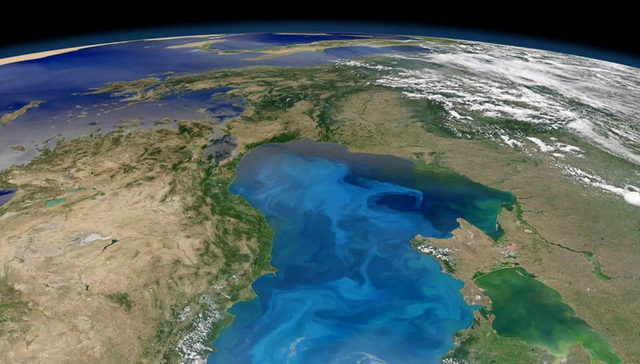
The area of the Black Sea is 422,000 km² (according to other sources - 436,400 km²). The outline of the Black Sea resembles an oval with the longest axis about 1150 km. The greatest length of the sea from north to south is 580 km. Greatest depth- 2210 m, average - 1240 m.
The sea washes the shores of Russia, Ukraine, Romania, Bulgaria, Turkey and Georgia. On the northeastern coast of the Black Sea there is an unrecognized public education Abkhazia.
A characteristic feature of the Black Sea is complete (with the exception of a number of anaerobic bacteria) absence of life at depths above 150-200 m due to the saturation of deep layers of water with hydrogen sulfide. The Black Sea is an important transport area, as well as one of the largest resort regions in Eurasia.
In addition, the Black Sea retains an important strategic and military significance. The main military bases of the Russian Black Sea Fleet are located in Sevastopol and Novorossiysk.
The ancient Greek name of the sea is Pont Aksinsky (Greek Πόντος Ἄξενος, “Inhospitable Sea”). In Strabo's "Geography" it is assumed that the sea received this name due to difficulties with navigation, as well as the wild hostile tribes inhabiting its shores. Later, after the successful development of the shores by Greek colonists, the sea began to be called Pontus Euxine (Greek Πόντος Εὔξενος, “Hospitable Sea”). However, Strabo (1.2.10) contains references to the fact that in antiquity the Black Sea was also called simply “sea” (pontos).
In Ancient Rus' X-XVI centuries in chronicles the name “Russian Sea” was found; in some sources the sea is called “Scythian”. The modern name “Black Sea” has found its corresponding reflection in most languages: Greek. Μαύρη θάλασσα, Bulgarian. Black Sea, cargo. შავი ზღვა, rum. Marea Neagră, English. Black Sea, tour. Karadeniz, Ukrainian Chorne More and others. The most early sources, mentioning this name refer to XIII century, however, there are certain signs that it was used before. There are a number of hypotheses regarding the reasons for this name:
The Turks and other conquerors who tried to conquer the population of the sea coast met fierce resistance from the Circassians, Circassians and other tribes, for which they called the sea Karadengiz - Black, inhospitable.
Another reason, according to some researchers, may be the fact that during storms the water in the sea becomes very dark. However, storms in the Black Sea are not too frequent, and the water darkens during storms in all the seas of the earth. Another hypothesis about the origin of the name is based on the fact that metal objects (for example, anchors) lowered into sea water deeper than 150 m at long time, became covered with a black coating due to the action of hydrogen sulfide.
Another hypothesis is related to the one adopted in a number of Asian countries“color” designation of the cardinal directions, where “black” denoted the north, respectively, the Black Sea - the northern sea.
One of the most common hypotheses is the assumption that the name is associated with memories of the Bosphorus breakthrough 7500-5000 years ago, which resulted in a catastrophic rise in sea level by almost 100 meters, which in turn led to the flooding of a vast shelf zone and the formation of the Sea of Azov .
There is a Turkish legend according to which a heroic sword rests in the waters of the Black Sea, which was thrown there at the request of the dying wizard Ali. Because of this, the sea is agitated, trying to throw out deadly weapons from its depths, and turns black.
The shores of the Black Sea are slightly indented and mainly in its northern part. The only large peninsula is Crimean. The largest bays are: Yagorlytsky, Tendrovsky, Dzharylgachsky, Karkinitsky, Kalamitsky and Feodosiysky in Ukraine, Varna and Burgassky in Bulgaria, Sinopsky and Samsunsky - on the southern shores of the sea, in Turkey. In the north and northwest, estuaries overflow at the confluence of rivers. The total length of the coastline is 3400 km.
A number of sections of the sea coast have proper names: South coast Crimea in Ukraine, the Black Sea coast of the Caucasus in Russia, the Rumelian coast and the Anatolian coast in Turkey. In the west and north-west the banks are low-lying, steep in places; in Crimea - mostly lowland, with the exception of the southern mountainous shores. On the eastern and southern shores, the spurs of the Caucasus and Pontic mountains come close to the sea.
There are few islands in the Black Sea. The largest are Berezan and Zmeiny (both with an area of less than 1 km²).
The following flow into the Black Sea: largest rivers: Danube, Dnieper, Dniester, as well as smaller Mzymta, Bzyb, Rioni, Kodor (Kodori), Inguri (in the east of the sea), Chorokh, Kyzyl-Irmak, Ashley-Irmak, Sakarya (in the south), Southern Bug (in the north ). The Black Sea fills an isolated depression located between Southeast Europe and the Asia Minor peninsula. This depression was formed in the Miocene era, during the process of active mountain building, which divided the ancient Tethys Ocean into several separate bodies of water (from which, in addition to the Black Sea, the Azov, Aral and Caspian seas were subsequently formed).
One of the hypotheses for the origin of the Black Sea (in particular, the conclusions of the participants in the international oceanographic expedition on the scientific vessel “Aquanaut” in 1993) states that 7,500 years ago it was the deepest freshwater lake on earth, the level was more than a hundred meters lower than the modern one . At the end of the Ice Age, the level of the World Ocean rose and the Bosphorus Isthmus was broken. A total of 100 thousand km² (the most fertile lands already cultivated by people) were flooded. The flooding of these vast lands may have become the prototype of the myth of the Great Flood. The emergence of the Black Sea, according to this hypothesis, was supposedly accompanied by the mass death of all the freshwater living world of the lake, the decomposition product of which - hydrogen sulfide - reaches high concentrations on the bottom of the sea.
The Black Sea depression consists of two parts - western and eastern, separated by a rise, which is a natural continuation of the Crimean peninsula. North West Side The sea is characterized by a relatively wide shelf strip (up to 190 km). The southern coast (belonging to Turkey) and the eastern (Georgia) are steeper, the shelf strip does not exceed 20 km and is cut by a number of canyons and depressions. Depths off the coast of Crimea and the Black Sea coast of the Caucasus are increasing extremely quickly, reaching levels of over 500 m already a few kilometers from the coastline. The sea reaches its maximum depth (2210 m) in the central part, south of Yalta.
The composition of the rocks that make up the seabed in the coastal zone is dominated by coarse sediments: pebbles, gravel, sand. As they move away from the coast, they are replaced by fine-grained sands and silts. Shell rocks are widespread in the northwestern part of the Black Sea; Pelitic silts are common on the slope and bed of the sea basin.
Among the main mineral deposits of which are found at the bottom of the sea: oil and natural gas on the northwestern shelf; coastal placers of titanomagnetite sands (Taman Peninsula, Caucasus coast). The Black Sea is the world's largest meromictic (with unmixed water levels) body of water. The upper layer of water (mixolimnion), lying down to a depth of 150 m, is cooler, less dense and less saline, saturated with oxygen, separated from the lower, warmer, saltier and dense layer saturated with hydrogen sulfide (monimolimnion) by a chemocline (the boundary layer between aerobic and anaerobic waters). zones). There is no single generally accepted explanation for the origin of hydrogen sulfide in the Black Sea. There is an opinion that hydrogen sulfide in the Black Sea is formed mainly as a result of the activity of sulfate-reducing bacteria, pronounced stratification of water and weak vertical exchange. There is also a theory that hydrogen sulfide was formed as a result of the decomposition of freshwater animals that died during the penetration of salty Mediterranean waters during the formation of the Bosphorus and Dardanelles.
Some studies in recent years suggest that the Black Sea is a gigantic reservoir of not only hydrogen sulfide, but also methane, most likely also released during the activity of microorganisms, as well as from the bottom of the sea.
The water balance of the Black Sea consists of the following components:
- atmospheric precipitation (230 km³ per year);
- continental runoff (310 km³ per year);
- water supply from the Sea of Azov (30 km³ per year);
- evaporation of water from the sea surface (-360 km³ per year);
- removal of water through the Bosphorus Strait (-210 km³ per year).
The amount of precipitation, inflow from the Sea of Azov and river runoff exceeds the amount of evaporation from the surface, as a result of which the level of the Black Sea exceeds the level of the Marmara Sea. Thanks to this, an upper current is formed, directed from the Black Sea through the Bosphorus Strait. Downstream, observed in lower layers of water, is less pronounced and is directed through the Bosphorus in the opposite direction. The interaction of these currents additionally supports the vertical stratification of the sea, and is also used by fish for migration between seas.
It should be noted that due to the difficult exchange of water with the Atlantic Ocean, there are practically no ebbs and flows in the Black Sea. The circulation of water in the sea covers only the surface layer of water. This layer of water has a salinity of about 18 ppm (in the Mediterranean - 37 ppm) and is saturated with oxygen and other elements necessary for the activity of living organisms. These layers in the Black Sea are subject to circular circulation in an anticyclonic direction along the entire perimeter of the reservoir. At the same time, in Western and eastern parts seas there are water circulations in a cyclonic direction. The temperature of the surface layers of water, depending on the time of year, ranges from 8 to 30 °C.
The lower layer, due to its saturation with hydrogen sulfide, does not contain living organisms, with the exception of a number of anaerobic sulfur bacteria (the waste product of which is hydrogen sulfide). Salinity here increases to 22-22.5 ppm, the average temperature is ~8.5°C.
The climate of the Black Sea, due to its mid-continental position, is mainly continental. Only the southern coast of Crimea and the Black Sea coast of the Caucasus are protected by mountains from the cold northern winds and as a result have a mild Mediterranean climate.
The weather over the Black Sea is significantly influenced by the Atlantic Ocean, over which the most of cyclones bringing to the sea bad weather and storms. On the north-eastern coast of the sea, especially in the Novorossiysk area, there are no high mountains are not an obstacle to cold northern air masses, which, when passing through them, cause a strong cold wind (bora), local residents call it Nord-Ost. South-westerly winds usually warm and fairly humid Mediterranean waters are brought to the Black Sea region air masses. As a result, most of the sea area is characterized by warm, wet winters and hot, dry summers.
average temperature January in the northern part of the Black Sea is −3 °C, but can drop to −30 °C. In the territories adjacent to the southern coast of Crimea and the Caucasus coast, winter is much milder: temperatures rarely drop below 0 °C. Snow, however, periodically falls in all areas of the sea. The average July temperature in the north of the sea is 22-23°C. Maximum temperatures are not so high due to the softening effect of the water reservoir and usually do not exceed 35 °C.
The greatest amount of precipitation in the Black Sea region falls on the coast of the Caucasus (up to 1500 mm per year), the least in the northwestern part of the sea (about 300 mm per year). Cloud cover for the year averages 60% with a maximum in winter and a minimum in summer.
The waters of the Black Sea, as a rule, are not subject to freezing, with the exception of the coastal part in the north of the reservoir. Coastal waters in these places they freeze for up to a month or more; estuaries and river branches - up to 2-3 months.
The flora of the sea includes 270 species of multicellular green, brown, and red bottom algae (Cystoseira, Phyllophora, Zostera, Cladophora, Ulva, Enteromorpha, etc.). The phytoplankton of the Black Sea contains at least six hundred species. Among them are dinoflagellates - armored flagellates (prorocentrum micans, ceratium furca, small Scrippsiella trochoidea, etc.), dinoflagellates (dinophysis, protoperidinium, alexandrium), various diatoms etc. The fauna of the Black Sea is noticeably poorer than that of the Mediterranean. The Black Sea is home to 2.5 thousand species of animals (of which 500 species are unicellular, 160 species of vertebrates - fish and mammals, 500 species of crustaceans, 200 species of mollusks, the rest are invertebrates of various species), for comparison, in the Mediterranean - about 9 thousand .species. Among the main reasons for the relative poverty of sea fauna: a wide range of water salinities, moderate cold water, the presence of hydrogen sulfide at great depths.
In this regard, the Black Sea is suitable for the habitat of fairly unpretentious species, at all stages of development of which great depths are not required.
At the bottom of the Black Sea live mussels, oysters, pecten, as well as the predator mollusk rapana, brought with ships from Far East. Numerous crabs live in the crevices of the coastal rocks and among the stones, there are shrimps, various types of jellyfish are found (the most common are Corneros and Aurelia), sea anemones, and sponges.
Among the fish found in the Black Sea: various types of gobies (bighead goby, whip goby, round goby, martovy goby, rotan goby), Azov anchovy, Black Sea anchovy, dogfish shark, glossa flounder, mullet of five species, bluefish, hake (hake), sea ruff, red mullet (common Black Sea mullet), haddock, mackerel, horse mackerel, Black Sea-Azov herring, Black Sea-Azov sprat, etc. There are sturgeon (beluga, stellate sturgeon, Black Sea-Azov ( Russian) and Atlantic sturgeon).
Among the dangerous fish of the Black Sea are the sea dragon (the most dangerous - the spines of the dorsal fin and gill covers are poisonous), the Black Sea and noticeable scorpionfish, the stingray (sea cat) with poisonous spines on the tail.
The most common birds are gulls, petrels, diving ducks, cormorants and a number of other species. Mammals are represented in the Black Sea by two species of dolphins (the common dolphin and the bottlenose dolphin), the Azov-Black Sea harbor porpoise (often called the Azov dolphin), and the white-bellied seal.
Some species of animals that do not live in the Black Sea are often brought into it through the Bosporus and Dardanelles straits by currents or swim on their own.
The history of the study of the Black Sea began in ancient times, along with the voyages of the Greeks, who founded their settlements on the seashore. Already in the 4th century BC, peripluses were compiled - ancient sailing directions of the sea. Subsequently, there is fragmentary information about the voyages of merchants from Novgorod and Kyiv to Constantinople.
Another milestone on the path to exploring the Black Sea was the voyage of the ship “Fortress” from Azov to Constantinople in 1696. Peter I, equipping the ship for voyage, gave the order to carry out cartographic work along the route of its movement. As a result, a “direct drawing of the Black Sea from Kerch to Tsar Grad” was drawn up, and depth measurements were taken.
More serious studies of the Black Sea date back to the end of the 18th-19th centuries. In particular, at the turn of these centuries, Russian scientists, academicians Peter Pallas and Middendorf, studied the properties of the waters and fauna of the Black Sea. In 1816, a description of the Black Sea coast appeared, made by F. F. Bellingshausen, in 1817 the first map of the Black Sea was published, in 1842 - the first atlas, in 1851 - the Black Sea navigational guide.
Systematic scientific research of the Black Sea began with two events at the end of the 19th century - the study of the Bosphorus currents (1881-1882) and the conduct of two oceanographic depth-finding expeditions (1890-1891).
Since 1871, a biological station has been operating in Sevastopol (now the Institute of Biology south seas), engaged in systematic research of the living world of the Black Sea. IN late XIX century, an expedition led by I. B. Spindler discovered the saturation of the deep layers of the sea with hydrogen sulfide; Later, a member of the expedition, the famous Russian chemist N.D. Zelinsky, gave an explanation for this phenomenon.
The study of the Black Sea continued after October revolution 1917. In 1919, an ichthyological station was organized in Kerch (later transformed into the Azov-Black Sea Institute of Fisheries and Oceanography, now the Southern Research Institute of Marine Fisheries and Oceanography (YugNIRO)). In 1929, a marine hydrophysical station was opened in the Crimea, in Katsiveli (now a branch of the Sevastopol Marine Hydrophysical Institute of the National Academy of Sciences of Ukraine).
In Russia, the main research organization conducting the study of the Black Sea is the Southern Branch of the Institute of Oceanology of the Russian Academy of Sciences (Gelendzhik, Blue Bay) and a number of others.
The Black Sea is of great transport importance for the economies of the states washed by this body of water. A significant volume of maritime traffic consists of tanker flights that ensure the export of oil and petroleum products from the ports of Russia (primarily from Novorossiysk and Tuapse) and the ports of Georgia (Batumi). However, the volumes of hydrocarbon exports are significantly limited by the limited throughput capacity of the Bosporus and Dardanelles straits. The largest oil terminal for receiving oil as part of the Odessa-Brody oil pipeline was created in Ilyichevsk. There is also a project for the construction of the Burgas - Alexandroupolis oil pipeline bypassing the Black Sea straits. Novorossiysk oil terminals are capable of receiving supertankers. In addition to oil and its products, metals, mineral fertilizers, machinery and equipment, timber, lumber, grain, etc. are exported from the Russian and Ukrainian ports of the Black Sea. The main volumes of imports into the Black Sea ports of Russia and Ukraine are consumer goods, food products, a number of raw materials, etc. Container transportation is widely developed in the Black Sea basin, and there are large container terminals. Transportation using lighters is developing; There are railway ferry crossings Ilyichevsk (Ukraine) - Varna (Bulgaria) and Ilyichevsk (Ukraine) - Batumi (Georgia). Marine passenger transportation is also developed in the Black Sea (however, after the collapse of the USSR, its volume decreased significantly). The international transport corridor TRACECA (Transport Corridor Europe - Caucasus - Asia, Europe - Caucasus - Asia) passes through the Black Sea. The Black Sea ports are the end points of a number of Pan-European transport corridors. The largest port cities on the Black Sea: Novorossiysk, Sochi, Tuapse (Russia); Burgas, Varna (Bulgaria); Batumi, Sukhumi, Poti (Georgia); Constanta (Romania); Samsun, Trabzon (Türkiye); Odessa, Ilyichevsk, Yuzhny, Kerch, Sevastopol, Yalta (Ukraine). Along the Don River, which flows into the Sea of Azov, there is a river waterway, connecting the Black Sea with the Caspian Sea (via the Volga-Don shipping canal and the Volga), with Baltic Sea and the White Sea (via the Volga-Baltic Waterway and the White Sea-Baltic Canal). The Danube River is connected to the North Sea through a system of canals. A unique deep-sea gas pipeline, the Blue Stream, connects Russia and Turkey, is laid along the bottom of the Black Sea. The length of the underwater part of the gas pipeline, running between the village of Arkhipo-Osipovka on the Black Sea coast of the Caucasus and the Turkish coast, 60 km from the city of Samsun, is 396 km. There are plans to expand the capacity of the gas pipeline by laying an additional branch of the pipe.
The following fish species are of commercial importance in the Black Sea: mullet, anchovy (anchovy), mackerel, horse mackerel, pike perch, bream, sturgeon, herring. Main fishing ports: Odessa, Kerch, Novorossiysk, etc.
In recent years XX - beginning of XXI century, fishing has declined significantly due to overfishing and deterioration of the ecological state of the sea. Prohibited bottom trawling and poaching are also a significant problem, especially for sturgeon. Thus, in the second half of 2005 alone, specialists from the Black Sea State Basin Department for the Protection of Aquatic Living Resources of Ukraine (“Chernomorrybvod”) uncovered 1,909 violations of fishery protection legislation in the Crimea and seized 33 tons of fish caught with illegal fishing gear or in prohibited places.
Favorable climatic conditions in the Black Sea region determine its development as an important resort region. The largest resort areas on the Black Sea include: the southern coast of Crimea (Yalta, Alushta, Sudak, Koktebel, Feodosia) in Ukraine, the Black Sea coast of the Caucasus (Anapa, Gelendzhik, Sochi) in Russia, Pitsunda, Gagra and Batumi in Georgia, Golden Sands and Sunny Beach in Bulgaria, Mamaia, Eforie in Romania.
The Black Sea coast of the Caucasus is the main resort region Russian Federation. In 2005, about 9 million tourists visited it; in 2006, according to officials' forecasts Krasnodar region, this region should have been visited by at least 11-11.5 million vacationers. There are over 1,000 boarding houses, sanatoriums and hotels on the Russian Black Sea coast, and their number is constantly growing. A natural continuation of the Russian Black Sea coast is the coast of Abkhazia, the most important resorts of which Gagra and Pitsunda were popular back in Soviet times. The development of the resort industry on the Black Sea coast of the Caucasus is hampered by the relatively short (for example, compared to the Mediterranean) season, environmental and transport problems, and in Abkhazia, also by the uncertainty of its status and the threat of a new outbreak of military conflict with Georgia.
The Black Sea coast and the river basins flowing into it are areas with high anthropogenic impact, densely populated by people since ancient times. The ecological state of the Black Sea is generally unfavorable.
Among the main factors that disrupt the balance in ecological system seas should be highlighted:
Severe pollution of rivers flowing into the sea, especially with runoff from fields containing mineral fertilizers, especially nitrates and phosphates. This entails overfertilization (eutrophication) of sea waters, and, as a consequence, rapid growth of phytoplankton (“blooming” of the sea - intensive development blue-green algae), decrease in water transparency, death of multicellular algae.
Water pollution with oil and oil products (the most polluted areas are the western part of the sea, which accounts for largest volume tanker transportation, as well as port waters). As a consequence, this leads to the death of marine animals caught in oil spills, as well as atmospheric pollution due to the evaporation of oil and petroleum products from the surface of the water.
Pollution of sea waters with human waste - discharge of untreated or insufficiently treated wastewater, etc.
Massive fishing.
Prohibited but widely used bottom trawling, which destroys bottom biocenoses.
Changes in composition, reduction in the number of individuals and mutation of the aquatic world under the influence anthropogenic factors(including the replacement of indigenous species of the natural world with exotic ones that appear as a result of human impact). For example, according to experts from the Odessa branch of YugNIRO, in just one decade (from 1976 to 1987) the number of Black Sea bottlenose dolphins decreased from 56 thousand to seven thousand individuals.
According to a number of experts ecological state The Black Sea has worsened over the past decade despite a decline in economic activity in a number of Black Sea countries.
The President of the Crimean Academy of Sciences, Viktor Tarasenko, expressed the opinion that the Black Sea is the dirtiest sea in the world.
To protect the environment in the Black Sea region, the ACCOBAMS agreement (“Agreement on the Conservation of Cetaceans of the Black Sea, Mediterranean Sea and Contiguous Atlantik Area”) was adopted in 1998, where one of the main issues is the protection of dolphins and whales. Main international document regulating the protection of the Black Sea is the Convention for the Protection of the Black Sea from Pollution, signed by six Black Sea countries - Bulgaria, Georgia, Russia, Romania, Turkey and Ukraine in 1992 in Bucharest (Bucharest Convention). Also in June 1994, representatives of Austria, Bulgaria, Croatia, the Czech Republic, Germany, Hungary, Moldova, Romania, Slovakia, Slovenia, Ukraine and European Union The Convention on Cooperation for the Protection and sustainable development Danube River. As a result of these agreements, the Black Sea Commission (Istanbul) was created, and International Commission for the protection of the Danube River (Vienna). These bodies perform the function of coordinating environmental programs implemented within the framework of the conventions. Every year on October 31, all countries of the Black Sea region celebrate International Black Sea Day.
The archives contain documents confirming that the first information about the Black Sea dates back to the 5th century. BC. It was along this route that the fearless Argonauts, led by Jason, set off to Colchis in search of the Golden Fleece, overcoming numerous obstacles. How has it not changed its name since then! The Black Sea ranks first in the world in this indicator. Since its first mention in documents, the name has changed about 20 times.
Where did the modern name come from?
Known different versions about its origin. The ancient Greeks called this sea Pont Aksinsky, which means “Inhospitable”. This name appeared due to problems with navigation among ancient sailors, despite the small size of the Black Sea in comparison with others. As soon as the colonists mastered the coast, it changed to Pont Euxine, which translates as “Hospitable”. In the 10th-16th centuries, the Russians called it the “Russian Sea” or “Scythian Sea”. The current name of this reservoir is Black.
Where does this name come from? The first sources of this name date back to the 13th century, although it is possible that it appeared much earlier. One hypothesis suggests that the name arose from a revolt of indigenous peoples against their conquerors. "Kara Denise" - "black, inhospitable." According to another version, migrants from southern countries that were observed during the storm dark sky merging with sea water. The reservoir actually looks black during thunderstorms.

Another theory modern name arose due to specific properties of a reservoir to “blacken” anchors and other objects at depth. This occurs due to the influence of hydrogen sulfide. According to other theories, the sea acquired its name because of the black silt that periodically washes up on the shore during a storm.
width Length
Herodotus tried to calculate the size of Pontus, measuring it in stages, which were calculated by the orgies (distance) traveled by the ship during the day. Its length, according to Herodotus, was 11,100 stadia, and its width at its most spacious was 3,300 stadia. Modern scientists are able to calculate the size of the Black Sea with an accuracy of up to a kilometer. Its greatest extent from east to west is a distance of over 1150 km, from the coast of Bulgaria to the coast of Georgia.
From the Ukrainian village of Koblevo to the coast of Turkey, the Black Sea measures (km) -616, from north to south. The shortest length is about 265 km. Geographers still cannot decide on the area, despite the known size of the Black Sea. According to some calculations, it occupies 422,000 km², and according to others - 436,400 km². The total length of the coastline is about 4100 km. The volume of water it can hold is about 555,000 cubic kilometers.

Since the dimensions of the Black Sea (width, length, depth) are relatively small, insignificant ebbs and flows are formed compared to other open water bodies. This is due to low water exchange with the Atlantic Ocean. The sea occupies a huge tectonic pit, the maximum depth of which is about 2245 m. In the west and north-west there are low coasts, but there are also steep areas. In Crimea they are predominantly low-lying, not counting the southern mountain coasts. From the eastern and south side The Caucasus and Pontic mountains come close to the sea.

At the confluence of rivers, shallow bays are formed - estuaries: Dniester, Khadzhibey, Kuyalnitsky, Tiligulsky, and Dnieper. The largest peninsula of the Black Sea is the Crimean peninsula, connected to the mainland thanks to the Perekop Isthmus. There are few islands in the Black Sea. The largest among them are Berezan and Zmeiny, each with an area of less than 1 km². The Kerch Strait, with a depth of 4 to 18 meters, connects the Black Sea with the Azov Sea. The Bosphorus and Dardanelles through the Marmara and Aegean Seas connect it with the Mediterranean.
Scientists have more than once considered theories that the Black Sea arose approximately 6000-8000 years ago, when the level of the world's oceans rose due to the melting of glaciers. With its rise in the Mediterranean Sea, it overcame a natural dam, which was today's Bosporus. After the breakthrough, a gigantic flow of water equal to the power of 200 Niagara Falls filled the current sea basin. This natural element is similar to the common version of the Flood as depicted in the Old Testament. It is important that the time of this largest natural disaster completely coincides with scientific and religious sources.
Among the many seas of the world (there are more than 50 of them), a special group consists of the so-called inland seas, more or less surrounded by land. In this group, which in Europe alone includes the White, Baltic, Mediterranean and Marmara Seas, the Black Sea, in terms of isolation from the Ocean, is second only to the Azov Sea. In fact, it is separated from the Atlantic Ocean by the Bosphorus Strait, the Sea of Marmara, the Dardanelles, the Mediterranean Sea and the Strait of Gibraltar. An equally complex waterway leads from the Indian Ocean.
Dimensions: The surface area of the Black Sea is 423,000 km, and the volume of its waters is 547,000 km. The greatest depth is 2,212 m. The length of the Black Sea coastline, according to recent estimates, reaches 4,340 km.
The Bosphorus Strait, or Bosphorus, is, in fact, a narrow channel 31 km long, 35 to 0.7 km wide and a minimum depth of 50 m. On the opposite side of the Black Sea is the Kerch Strait, connecting it with Sea of Azov. The length of this strait is about 45 km, the width is from 3.5 to 42 km, and the minimum depth is only 10 m. However, the small Sea of Azov (surface of about 39,000 km") is itself shallow and a maximum depth of 13 m can be found in a very limited area in the very center of the reservoir.
Coastline The sea forms several bays, peninsulas and capes protruding deep into the sea. The largest peninsula is the Crimean peninsula, ending in the west with the Tarkhankut peninsula, and in the east with the Kerch peninsula. On the eastern side of the Kerch Strait is the Taman Peninsula. The most prominent capes are: Kaliakra in Bulgaria, Midia in Romania, Bolshoy Fontan, Tarkhankut, Chersonese, Methanom and Chauda in Ukraine, and Myskhako in Russia, Pitsunda in Georgia, Cham, Bafra, Boztepe, Ijeburun and Olujs in Turkey. The largest bays and bays are: Burgas and Varna bays in Bulgaria, Mamaia Bay in Romania, Odessa, Teidrovsky, Egorlytsky, Dzharylgachsky, Karkipitsky, Kalamitsky and Feodosiya bays in Ukraine, Novorossiysk and Gelendzhik bays in Russia, Samsun and Sinop bays in Turkey.
The landscape diversity of the Black Sea coasts is very great. There are high mountains and vast valleys, wet areas with subtropical vegetation and dry areas, numerous estuaries, lagoons and river deltas.
The Black Sea is not rich in islands of continental origin. The largest of them, Snake Island (in ancient times - Levka, Fidonisi), with an area of 1.5 km and a height of up to 40 m above sea level, is located 37 km east of the Kiliya branch of the Danube delta. Another island, Berezan,
with an area of about 0.5 km" and a height of up to 20 m, is located 1 km from the mouth of the Berezansky estuary. Another island, Kefksn, is located near the coast, 90 km east of the entrance to the Bosphorus. Several very small islands, in fact, rocks , are available in the Burgas Bay.
Sandy islands washed up by currents can reach significant sizes. These are: Tepdra Island, or Tendra Spit, about 65 km long and an area of about 30 km, Dzharylgach Island, 42 km long, with an area of about 25 km, Dolgiy Island, with an area of 3.5 km, and some others, all in the northwestern part of the sea.
In any sea there are shelves - continuations of continents under water. These are zones with depths of less than 200-150 m. In the Black Sea, due to the characteristics of its waters, the shelves are the only areas of the bottom inhabited rich life. total area The Black Sea shelf is about 100,000 km." Of these, 64,000 km" are located in the northwestern part of the sea, opposite the coasts of Ukraine, Romania and Bulgaria. The shelf width here reaches 150-180 km in places. In other areas adjacent to mountainous terrain, the shelf narrows to 10, and in some places to 2 km.
The central part of the sea - an area with depths of 2000-2212 m - is basically a flat bottom with minor depressions and elevations, covered with a layer of sediment from 2 to 15 (!) kilometers thick. Some researchers believe the Black Sea deep-sea trench remnant of the Tethys Sea.

There is a certain classification for the seas. For example, more than 50 seas are classified as “inland”, that is, they are surrounded by land on three sides. The seas of this group are also called “hotel seas”. In Europe, this group includes the Mediterranean, White, Baltic, Marmara and Black Seas.
They differ in the degree of their isolation from the Ocean. According to this criterion, the Black Sea is closest to the Azov Sea. In fact, the “obstacles” on the way of the Black Sea to Atlantic Ocean are the Bosphorus and Dardanelles straits, the Mediterranean and Marmara seas and the Strait of Gibraltar. A path of equal complexity leads from Indian Ocean to the Black Sea.
The Bosphorus Strait is quite narrow water channel. Its length is 31 km, width 35 km. Minimum depth - 50m. The Black Sea is connected to the Sea of Azov by the Kerch Strait. It is longer than the Bosphorus by about 10 km, and its width is slightly less than 42 km. The minimum depth of the strait is 10 m. The Sea of Azov itself is also not very deep (the maximum is only 13 m in the middle part of the sea!). Its surface is 39 thousand km.
The surface of the Black Sea is 423 thousand kilometers in area. The volume of water in it is 547 thousand kilometers. Maximum depth is 2212 km. The length of the Black Sea coastline reaches approximately 4340 km. Among countries with access to the sea, it is distributed approximately in the following order: (in alphabetical order country names): Bulgaria 300 km, Georgia 310 km, Russia 475 km, Romania 225 km, Turkey 1,400 km and Ukraine 1,628 km.
The coast of the Black Sea is not smooth - bays, peninsulas and capes are formed in it, which cut deeply into the sea. The largest Black Sea peninsula is the Crimean peninsula. In the west it is limited by the Tarnhakut Peninsula, and in the east by the Kerch Peninsula. To the east of the Kerch Strait is the Taman Peninsula. The largest Black Sea capes are the Bulgarian Kaliakra and the Romanian Midia. It is also worth mentioning the Ukrainian capes - Chersonesos, Methanome, Chaudra and many others. Capes Myskhako and Utrish are located in Russia, and Pitsunda is in Georgia. A number of large capes are located in Turkey (Boztepe, Cham, Ijeburun, etc.). Regarding bays and bays, the largest are considered to be the Bulgarian Burgas and Varna bays, the Romanian Mamaia Bay, Odessa, Egorlytsky, Teidorovsky and Feodosia bays in Ukraine. On the territory of our country, the largest bays are Gelendzhik and Novorossiysk. In Turkey there are large bays - Samsun and Sinop.
The shores of the Black Sea are very diverse in their landscape and relief. You can find here wide valleys, high mountains, areas of moisture-rich subtropics and areas suffering from drought. Often there are also estuaries, river deltas and real lagoons!
The islands in the Black Sea are mostly of non-mainland origin. The largest of the mainland islands is called Snake Island (in ancient times it was called Levka or Fidonisi). Its area is 1.5 km and its height above sea level is 40 m. Snake Island is located east of the Chilia branch of the Danube delta at a distance of approximately 37 km . Another large island of the same origin is Berezan, with an area of about 0.5 km and a height of up to 20 m. It can be found at a distance of 1 km from the mouth of the Berezan Estuary.
Another mainland island is Kefkas. It is located 90 km from the entrance to the Bosphorus Strait, quite close to the shore. Similar islands can be found in the Burgas Bay.
Sometimes the sea brings a lot of sand to one area, forming sand islands. They can be quite large in size. For example, Tendrovsky Island is sandy. Its length is about 65 km. Area - about 30 km. There are also the islands of Dzharylgach, whose length is 42 km, and the area is about 25 km and Dolgiy, with an area of 3.5 km and others. Sandy islands are located in the northwestern part of the Black Sea.
There are also shelf zones in the Black Sea - these are extensions of the mainland under water. The depth of these zones is no more than 150-200 m. The Black Sea shelves are quite densely populated various organisms. The area of the Black Sea shelf zone is about 100 thousand kilometers. 64 thousand of these hundred are in the north-west, opposite Ukraine, Romania and Bulgaria. The width of the local shelf can be up to 150-180 kilometers. In other areas, the width of the shelf may decrease to 10 or even 2 km.
The central region of the Black Sea has a depth of approximately 2000-2212 meters. This area is flat, without any significant elevation changes. It is covered with a sedimentary layer from 2 to 15 km in thickness. Scientists believe that central part the Black Sea bottom are the remains ancient ocean Tethys.
- Taiga tea: composition, indications and storage conditions for the collection Taiga tea
- What meat is the healthiest for humans?
- Signs for the Annunciation of the Blessed Virgin Mary, as well as rituals and prohibitions Annunciation customs and signs what you can do
- Mushroom picking: general rules and advice for a novice mushroom picker Dream of picking mushrooms in the forest